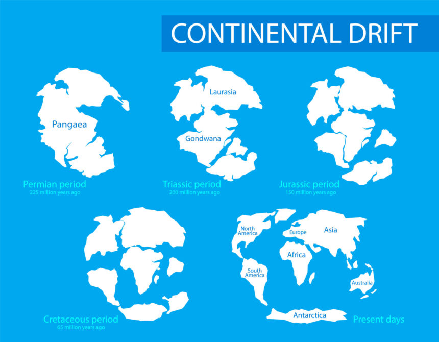
Continental Drift Theory is an idea from science fiction. But did you know the very ground beneath your feet is constantly shifting? This revolutionary theory explains how our continents transformed from a single landmass into the world we know today.
⫸ What is Continental Drift Theory?
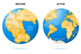
Continental drift theory revolutionized our understanding of Earth. It suggests that the continents we know today were once part of a single supercontinent that gradually broke apart and drifted into their current positions.
Continental Drift Theory - Definition
- Continental drift theory is a ground-breaking scientific concept that proposes Earth’s continents were once joined in a massive supercontinent and have slowly drifted apart over millions of years.
- This ongoing movement reshapes our planet, influencing the formation of mountains, oceans, and the land we walk on.
Continental Drift Theory Proposed By
Alfred Wegener, a German meteorologist and geophysicist, first championed the continental drift theory in the early 20th century.

He faced initial skepticism, but his meticulous observations of coastlines, fossils, and geological features laid the foundation for the modern understanding of how the Earth’s surface changes.
⫸ Evidence Supporting Continental Drift Theory
The idea of continents moving might seem far-fetched, but a wealth of scientific evidence supports continental drift theory.
The Jigsaw Fit of Continents
- The most obvious clue is how the coastlines of certain continents fit together like puzzle pieces.
- South America’s eastern edge and Africa’s western bulge are a striking example.
Continental Drift Theory Fossil Evidence
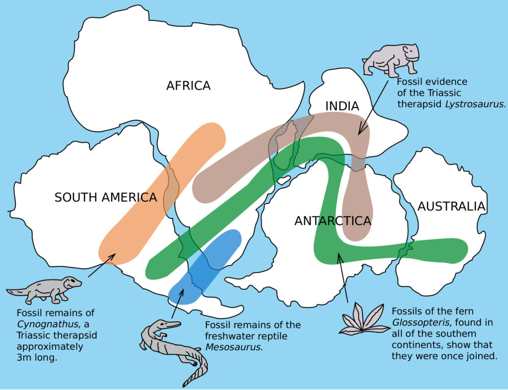
- Fossils of identical plant and animal species are found on continents now separated by vast oceans.
- One example is the Mesosaurus, a freshwater reptile whose remains are found only in South Africa and Brazil.
Matching Rock Types and Mountain Ranges
- Geologists discovered rock formations and mountain ranges with identical structures and ages on different continents.
- For instance, portions of the Appalachian Mountains in the United States closely match mountain ranges in Scotland and Norway.
Evidence From Ancient Climates
- Evidence of glaciers in present-day tropical regions suggests these landmasses were once near the poles.
- Coal deposits from ancient tropical swamps are found in frigid locations like Antarctica, indicating a warmer past climate.
Matching Geological Formations
- Specific geological features extend across continents as though they were once connected.
- Glacial deposits with unique patterns are found across South America, Africa, India, and Australia in a way that only makes sense if they were once part of a landmass near the South Pole.
⫸ Pangaea - The Supercontinent
Pangaea, meaning “all lands,” was the Earth’s most recent supercontinent, a vast landmass that shaped our planet’s history.
What was Pangaea?
- Pangaea was a C-shaped supercontinent that existed hundreds of millions of years ago.
- It encompassed nearly all of Earth’s landmasses, surrounded by a global ocean called Panthalassa.
- Pangaea’s formation dramatically affected animal and plant life, impacting evolution and biodiversity.
When Did Pangaea Exist?
- Pangaea began to assemble during the late Paleozoic Era, approximately 335 million years ago.
- It reached its final form in the Early Permian Epoch (about 299 million to 273 million years ago).
- During the Early Jurassic Epoch, Pangaea started to break apart roughly 200 million years ago.
Evidence for Pangaea's Existence
- Fossil Distribution: Identical plant and animal fossils found on widely separated continents suggest they were once connected.
- Rock and Mountain Continuity: Matching geological formations and mountain ranges span continents, hinting at a shared origin.
- Paleoclimate Clues: Evidence of glaciers in now tropical regions point to continents previously positioned in colder areas.
Pangaea’s Breakup and the Continents Today
- Tectonic forces caused Pangaea to fragment into two supercontinents: Laurasia (north) and Gondwana (south).
- Continued drifting shaped our modern continents and oceans.
- This process is ongoing; continents continue to move slowly, reshaping the world map even today.
⫸ How Plate Tectonics Explains Continental Movement?
While continental drift theory laid the groundwork, plate tectonics provides a more comprehensive explanation for continental movement. Imagine Earth’s surface as a giant jigsaw puzzle, broken into numerous rigid plates that float on a hot, semi-molten layer of the mantle called the asthenosphere. These plates are constantly in motion, driven by convection currents within the mantle.
Seafloor Spreading: This key process occurs at mid-ocean ridges, where hot magma rises from the mantle, pushing tectonic plates apart. As the plates diverge, the magma cools and solidifies, forming a new ocean floor. This continuous creation of new seafloor explains the immense width of oceans and why continents on either side fit together like puzzle pieces.
Subduction Zones: Not all plate boundaries involve divergence. When plates collide, one plate may be forced beneath the other, a process known as subduction. This subduction zone typically involves a denser oceanic plate diving beneath a less dense continental plate. The subducted plate melts partially due to the immense heat and pressure, and this molten rock can rise again, forming volcanoes on the overriding plate. Subduction is also crucial in mountain building as the continental crust crumples and compresses at the collision zone.
Transform Faults: These boundaries occur when plates slide past each other horizontally, creating immense friction. This friction can cause massive earthquakes like those along the San Andreas Fault in California. Transform faults don’t directly create or destroy continents but contribute to the overall movement and reshaping of the Earth’s crust.
By understanding these interactions between plates, plate tectonics paints a more vivid picture of continental movement. It explains the ongoing continental drift and the formation of volcanoes, mountain ranges, and even the very shape of our oceans.
⫸ Challenges to Continental Drift Theory
While ground-breaking, Alfred Wegener’s continental drift theory faced significant criticism during its initial proposal. Here’s an examination of the key challenges that cast doubt on its validity:
Lack of a Convincing Mechanism:
Wegener couldn’t provide a strong explanation for the forces powerful enough to move entire continents. He suggested tidal forces and the Earth’s rotation might play a role, but these were deemed too weak.
Contradiction with Prevailing Theories:
Continental drift clashed with the widely accepted geosyncline theory used to explain mountain formation. This theory emphasized long-term, slow Earth crust changes, while continental drift implied rapid, large-scale movements.
Issues with Geological Fit:
While the coastline fit of some continents seemed striking, critics argued that a perfect fit was unlikely. They pointed to factors like erosion and sediment buildup that would alter coastal shapes over time.
Questions about Oceanic Crust:
If continents plowed through the seafloor, what happened to the displaced material? The absence of crumpled and deformed oceanic crust in the path of the continents posed a problem.
Disagreement from the Scientific Community:
The geology establishment of Wegener’s time was hesitant to embrace such a radical concept. Many scientists had built their careers on the existing geosyncline theory and were reluctant to accept a fundamental shift in perspective.
Limitations Fuelling a New Theory
While Wegener’s hypothesis had weaknesses, it sparked crucial questions and observations. The limitations of continental drift theory ultimately paved the way for the development of plate tectonics, a more comprehensive model that explains the dynamic movement of the Earth’s surface.
⫸ What is the importance of continental drift theory?
Continental drift theory provides a framework for understanding how Earth’s features and life forms have evolved over time. It helps explain major geological events the distribution of plants and animals, and offers insights into the planet’s future.
Earthquakes and Volcanoes – Where Continents Collide
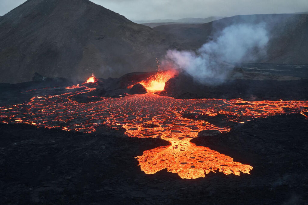
Continental drift underpins the theory of plate tectonics. Where plates collide, immense forces cause earthquakes and volcanic activity. The infamous “Ring of Fire” around the Pacific Ocean is a prime example of this dynamic process.
Formation of Mountains
The Earth’s crust buckles and folds when continents crash together, creating towering mountain ranges. The Himalayas, formed by the collision of India and Asia, are a spectacular testament to this process.
Ocean Basins and Continental Shelves
As continents pull apart, vast ocean basins form between them. The Atlantic Ocean is a result of such a split. Along the edges of continents, the submerged continental shelves provide rich habitats for marine life.
Predicting Future Continental Movement
Continental drift is a slow but ongoing process. Scientists meticulously track plate movements to model how Earth’s continents might rearrange in the distant future. While change is gradual on a human timescale, it’s dramatic over geological timespans.
⫸ Conclusion
Continental drift theory, once considered outlandish, profoundly changed our understanding of the planet. It’s far from a static image of Earth; it’s a dynamic system constantly in motion. From the fossils of ancient creatures to the earthquakes that rumble beneath our feet, the evidence for continental drift is woven into the very fabric of our world.
The theory highlights the interconnectedness of Earth’s systems and the immense power of change over time. As we learn more about plate tectonics and geological processes, we become better equipped to predict natural hazards and understand the delicate balance of our planet’s future.
Call to action: If you’re fascinated by the ever-changing Earth, explore resources on plate tectonics and continental drift – your journey of discovery has just begun!
