Introduction:
The atmosphere is a realm of constant flux and fascinating phenomena. We expect warm air near the Earth’s surface, gradually cooling as we venture higher into the sky. But nature sometimes has a twist in store—a phenomenon known as a temperature inversion. Imagine climbing a mountain only to find the air growing warmer instead of colder. This unexpected reversal of the normal temperature gradient hints at the atmosphere‘s hidden complexities.

Temperature inversion defies our everyday expectations. It creates layers where rules seem to bend, where warmer air rests like a blanket over cooler air below. These atmospheric anomalies are more than just meteorological curiosities. Temperature inversion can shape weather patterns, influence air quality, and even alter how we experience the world around us.
What is Temperature Inversion?
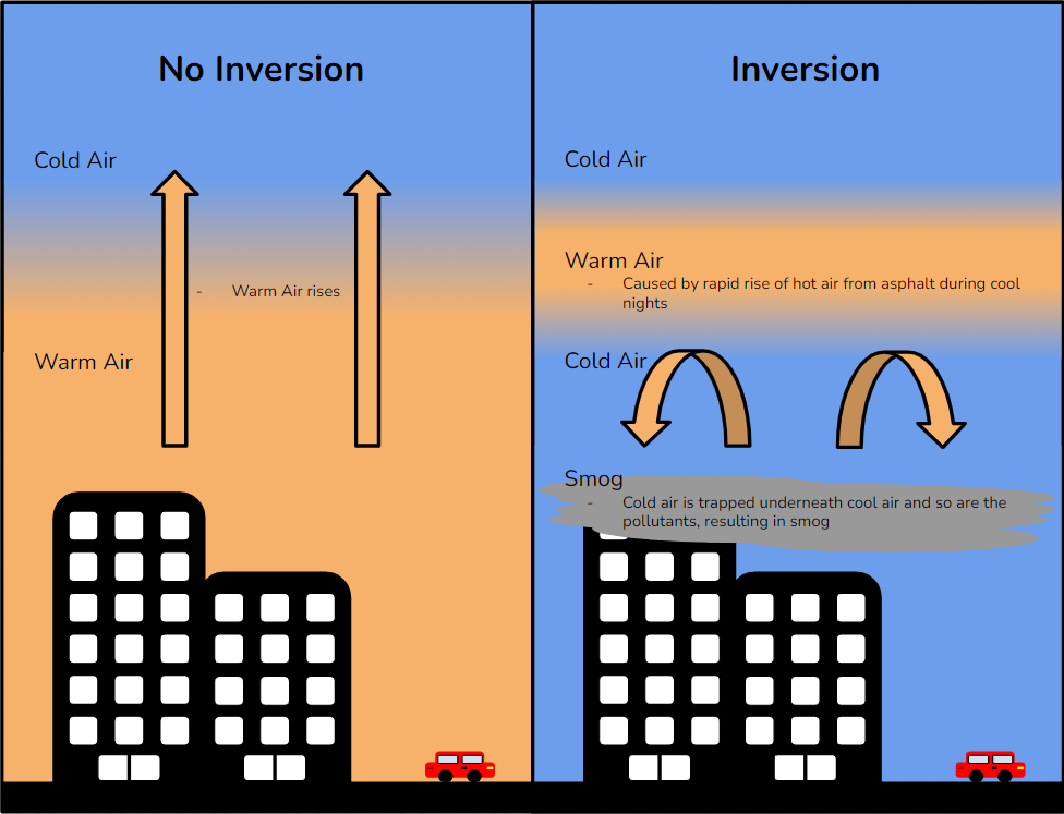
We typically expect air temperature to decrease in the Earth’s atmosphere as altitude increases. However, an inversion temperature disrupts this normal pattern. Temperature inversion is a meteorological phenomenon where a layer of warm air sits atop a layer of cooler air in the lower atmosphere. This reverses the usual pattern where temperature decreases with increasing altitude.
Temperature inversions are like atmospheric hiccups; they temporarily flip the typical temperature arrangement. Various factors can cause these inversions, which significantly impact weather, air quality, and daily experiences.
Normal Atmospheric Condition:
The Earth’s surface acts as the primary heat source for the lower atmosphere. Sunlight warms the ground, transferring heat to the air in contact. This heat transfer happens through conduction, convection, and radiation. The warmed ground emits infrared radiation, which can be absorbed by air molecules, further contributing to their heating.
As we move higher in the atmosphere, the air becomes farther from the heat source (the ground). With less heat transfer, the air molecules have less thermal energy, decreasing temperature. This decrease is what we call the normal lapse rate.
It’s typically around 6.5°C per kilometer (or 1.98°C per 1,000 feet). This means that for every kilometer you climb, the average temperature drops by about 6.5°C.
Ideal Conditions for Temperature Inversion:
Several factors can contribute to the formation of such inversion, as actual atmospheric conditions can vary depending on factors like humidity, wind patterns, and time of day.
Radiational Cooling in Clear Nights: Clear, calm nights are ideal for temperature inversions. Without cloud cover to trap it, the ground loses heat rapidly through radiation, which cools the air near the surface significantly.
Still Air: Wind and turbulence mix the air, disrupting the formation of distinct layers. Temperature inversions are more likely with minimal wind, allowing the cool air to settle near the ground.

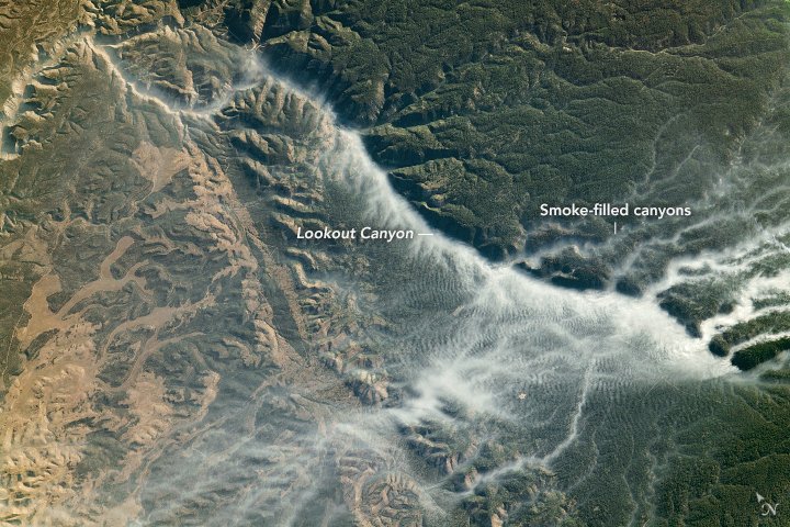
Valley Topography: Valleys and basins are prone to temperature inversions. Cool, dense air drains downslope and pools in these low-lying areas, becoming trapped beneath warmer air.
Availability of Dry Air: Humid air tends to absorb more of the Earth’s radiated heat, limiting the cooling effect near the ground necessary for a strong inversion.
Prevalence of Subsiding Air: High-pressure systems are associated with sinking air. As this air descends, it compresses and warms, potentially creating a temperature inversion if it forms a layer over cooler air below.
Types of Temperature Inversions:
Not all temperature inversions are created equal. Here’s a breakdown of some common types:
- Ground (Radiation) Inversion: The most frequent type, often forming on clear nights as the ground cools.
- Frontal Inversion: This type occurs when a warm air mass slides over a cooler air mass along a weather front.
- Subsidence Inversion: Formed due to descending air in high-pressure systems, often quite strong and persistent.
- Vertical Inversion: A common occurrence in valley regions.
Monitoring Temperature Inversions:
Meteorologists use various tools to track and predict temperature inversions:
- Weather Balloons: These carry instruments that measure temperature and other data as they ascend through the atmosphere, revealing inversion layers.
- Weather Satellites: Satellites collect thermal data, helping to identify and map inversions.
- Computer Models: Sophisticated weather models analyze atmospheric conditions and predict the likelihood of inversions forming.
Impact of Temperature Inversion:
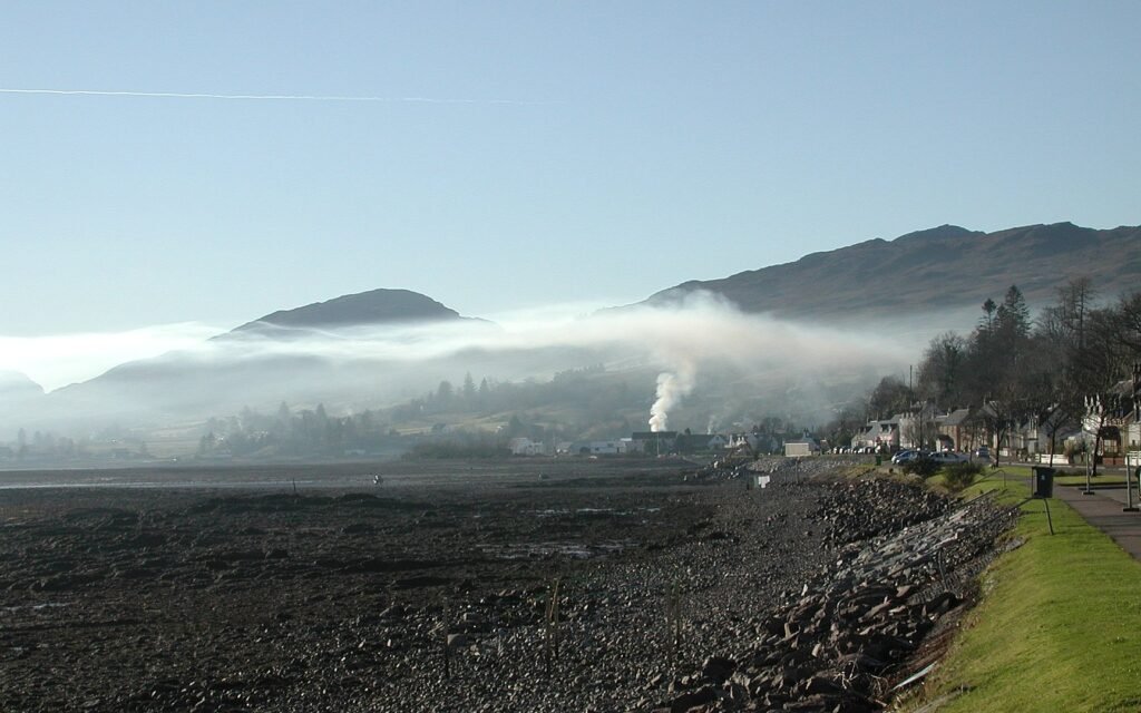
- Temperature inversions act like a lid, trapping pollutants, dust, and smoke close to the ground. This can lead to severe air pollution episodes, especially in urban areas surrounded by hills or mountains, exacerbating respiratory problems for vulnerable populations.
- When the cool air beneath an inversion layer becomes saturated, thick fog can develop, reducing visibility and creating hazardous conditions for transportation.
- Temperature inversions can increase the risk of frost damage to crops as the cold, dense air settles in low-lying areas where plants are more vulnerable.
- Temperature inversions can bend and refract sound waves, causing sounds to carry for surprisingly long distances or seem to come from unusual directions.

Conclusion:
Temperature inversions, though often hidden from our casual observation, play a surprisingly significant role in shaping our world. These atmospheric anomalies, from the hazy air lingering over cities to the unexpected frosts threatening crops, leave their mark. They remind us that the atmosphere is never truly static, always holding the potential for the unexpected.
Understanding temperature inversions helps us make sense of both local weather patterns and far-reaching environmental concerns. Their impact on air quality underscores the delicate interplay between human activity and natural systems. Studying temperature inversions gives us a deeper appreciation for the intricate dance of warm and cool air layers within our planet’s embrace.


